Compared to most countries, Australia is pretty flat. So flat in fact, that the flat white coffee was invented here because navigating the frothy peaks of a venti cappuccino will often give an Australian a bad case of vertigo.
You’d expert the middle bit of Australia to be the flattest, as it is largely desert, but somehow we did the most hiking and rock climbing here in the Red Centre of Australia.
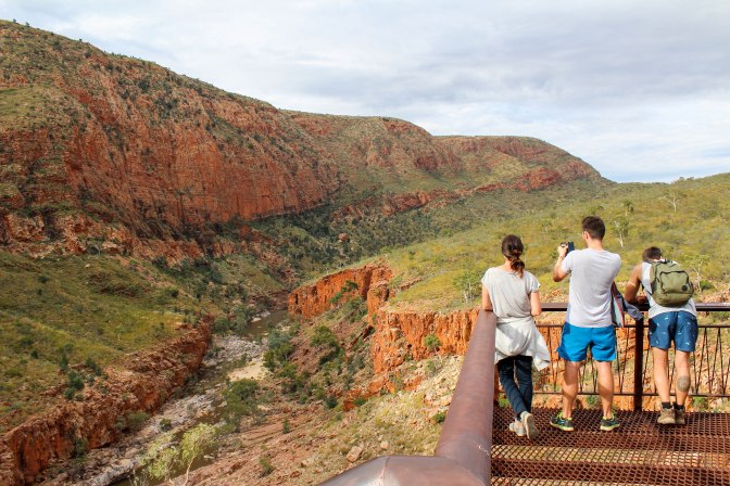
Hike 1: Kings Canyon rim walk
After traipsing around Uluru and Kata Tjuta for a few days we returned north towards Alice Springs to find Kings Canyon. It’s about 3.5-4 hours along the sealed Lasseter Highway to Kings Canyon, but if you have an offroad vehicle and balls of steel, you could attempt the shortcut known as the Red Centre Way. Kings Canyon sits within Watarrka National Park, which covers about 71,000 hectares (274 square miles) and has been home to the Luritja Aboriginal people for more than 20,000 years.
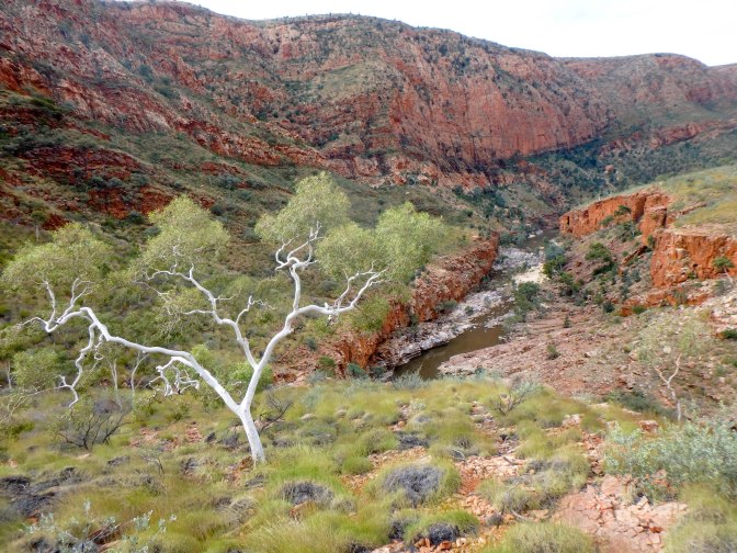
We did the 6 kilometre Kings Canyon rim walk, which, aside from the 500 step climb at the beginning, was a breeze compared to the entirely flat Uluru 10 kilometre base walk. Possibly because we were distracted by the changing views of the canyon as we oscillated between the 300 metre high cliffs and picturesque rock pools at the bottom of the gorge. There are gates that stop you beginning the rim walk after 9am on any day over 36 degrees celsius, so there is some danger there, but to be honest we were more worried about falling off the edges of the canyon rim. It’s a long way down.


Walking through the ‘Lost City’ of beehive-like domes gave us a sense of what exploring the Kimberley’s Bungles Bungles on foot may have been like (but at least three times bigger). We also saw the remains of an ancient sea bed. Finding outback marine fossils has been an unexpected but welcome theme of our roadtrip around Australia. Gareth’s totem animal must be a bi-valve.
Climbing down into the ‘Garden of Eden’ at the bottom of the gorge we also saw cycad ferns, which date all the way back to the time of the dinosaurs!


Hike 2: Ormiston Gorge and Pound circuit
That night we stayed at a free camp on the outskirts of Alice Springs between the rubbish piles and the runway. You can find it on Wikicamps if you’re desperate but we wouldn’t rate it as a top spot for campervans. The following day we drove out to the West MacDonnell Ranges. It’s another 160 kilometres west of Alice Springs but if we had known better we would have bunked down at one of the campsites here overnight instead.
After taking a look at Simpsons Gap, we decided to stretch the legs with another hike. There are quite a few stops along Larapinta Drive to choose from but we picked Ormiston Gorge. It takes about 3-4 hours to complete a circuit of Ormiston Pound and there’s a permanent waterhole at the end that you can swim in. We attempted to return via the river and got a little stuck, however it was lots of fun to scramble from rock to rock – the boulders in the river change colour in the dying light from grey to pink and purple. All of our hikes in the Red Centre and the wider Northern Territory have been absolutely beautiful, worthwhile as long as you can manage the heat properly. We learned from our mistakes hiking Katherine Gorge and brought plenty of water.


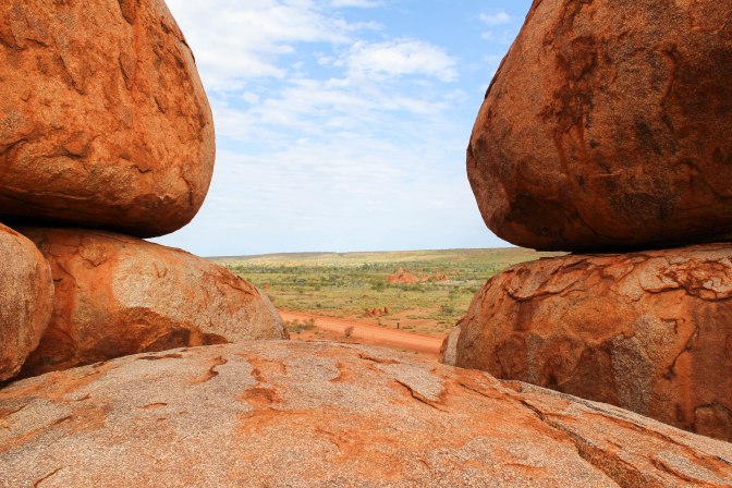
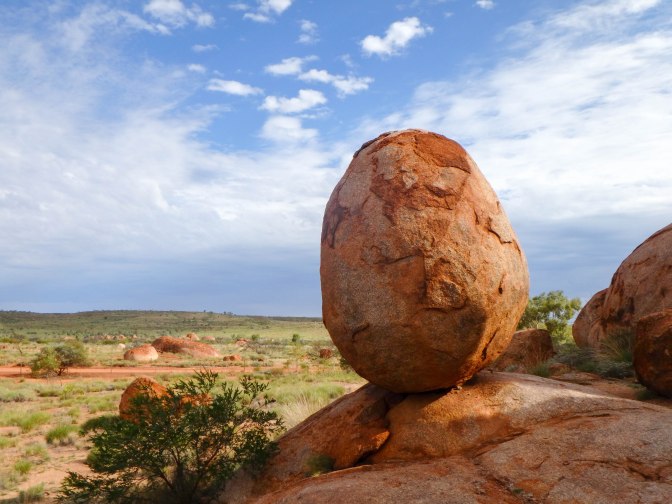
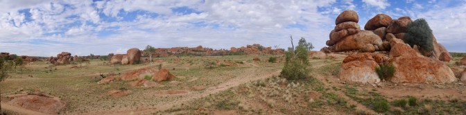
Hike 3: Devils Marbles
Our last hike on the way out of the NT was the Devils Marbles geological formation, a pit stop on the Stuart Highway about 100 kilometres south of Tennant Creek. Make sure you get out of your campervan or backpacker bus and spent some time walking around this site. It will be the most interesting thing you see for many hundreds of kilometres, whether you’re travelling north to Darwin or east to Queensland.
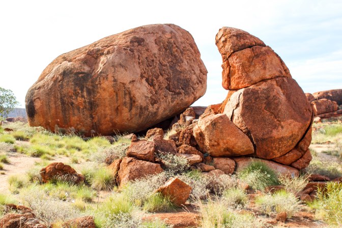
The Devil’s Marbles, known by the local indigenous people as Warlu Warlu, are a collection of red, round granite boulders. It’s the roundness of them that blows your mind, they almost look man made. In fact, they’re the eggs of the Rainbow Serpent, so keep that in mind as you slide around their convex curves and refrain from carving JACE WOZ ERE ’17.
You can camp here too and catch the Marbles by sunset, which is apparently spectacular. In theory it’s also safer to camp around lots of people at this major tourist attraction, as the Stuart Highway rest stops have a well deserved creep factor for backpackers.


Highs: The geological wonderment of the Red Centre’s gorges, gaps and granite eggs
Lows: We now have to drive over 1,500 kilometres of flat, flat road from Tenant Creek to Townsville


Damn look at those canyons! Looks so nice….how far is this located from Sydney? Awesome photos, happy travels!
LikeLiked by 1 person
Thanks! The drive from Sydney would be pretty epic – about 2,800km (30hrs). But there are direct flights from Sydney and lots of tour companies that would drive you around to the different sites.
LikeLiked by 1 person
30 hours that sounds actually really fun haha..but yeah..with time constraints probably need to fly direct and hire a tour guide…though it’s not as fun i presume..
LikeLike
Amazing trail! Good luck and happy travels.
LikeLiked by 1 person
Thanks. Will be using your great blog when planning our next trip to Asia
LikeLiked by 1 person